


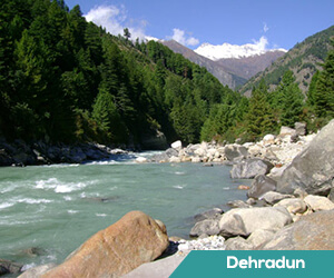
Choppers to be GPS-enabled, aviation authority to monitor flying height
Summary: This limit will not be applicable during take off or landing.The choppers will have to install the Global Positioning System (GPS) and Uttarakhand Civil Aviation Development Authority (UCADA) will monitor the height the helicopters are flying at. It was decided during the meeting that choppers will have to adhere to the norms laid down by the National Green Tribunal (NGT) and fly 600 metres above the ground. DEHRADUN: Days after the DGCA cancelled permission granted to 14 heli-charter companies to operate flights to Kedarnath, chief secretary S Ramaswamy held a meeting with chopper operators and scientists from Wildlife Institute of India on Wednesday. Since it will not be possible for choppers to maintain a height of 600 metres from Sirsi helipad which is close to the Kedarnath Wildlife Sanctuary (KWLS), it was decided that the helicopters will fly away from KWLS and then return after gaining a height of 600 metres to fly over the sanctuary.In case pilots are compelled to fly lower than 600 metres during bad weather, the chief secretary said that the pilot can enter the alteration in his log book and send a report to district magistrate, divisional forest officer of KWLS and UCADA.
DEHRADUN: Days after the DGCA cancelled permission granted to 14 heli-charter companies to operate flights to Kedarnath, chief secretary S Ramaswamy held a meeting with chopper operators and scientists from Wildlife Institute of India on Wednesday. It was decided during the meeting that choppers will have to adhere to the norms laid down by the National Green Tribunal (NGT) and fly 600 metres above the ground. This limit will not be applicable during take off or landing.The choppers will have to install the Global Positioning System (GPS) and Uttarakhand Civil Aviation Development Authority (UCADA) will monitor the height the helicopters are flying at.
Since it will not be possible for choppers to maintain a height of 600 metres from Sirsi helipad which is close to the Kedarnath Wildlife Sanctuary (KWLS), it was decided that the helicopters will fly away from KWLS and then return after gaining a height of 600 metres to fly over the sanctuary.In case pilots are compelled to fly lower than 600 metres during bad weather, the chief secretary said that the pilot can enter the alteration in his log book and send a report to district magistrate, divisional forest officer of KWLS and UCADA.. . .
Source: http://timesofindia.indiatimes.com/city/dehradun/choppers-to-be-gps-enabled-aviation-authority-to-monitor-flying-height/articleshow/58520884.cms


